

I travel a lot, and I always find it interesting to learn what people in other countries know and think about Canada. Occasionally I’ll bump into someone who’s really in the know, but by and large, when asked, the vast majority can come up with little more than the notion that Canada is cold, big and empty.
I used to scratch my head when people expressed that view, wondering why they’d come up with something so simplistic. But after a recent trip I made to Canada’s Arctic I’m here to tell you they were right all along. Canada is indeed cold, big, and empty. Jump in your car and drive and you’ll see what I mean.
In the good old days getting to the Arctic Ocean (in Canada anyway) wasn’t easy. There are limited options: You can drive north a long way in Quebec and Newfoundland, but not all the way to the ocean. You could apply to volunteer with a development project somewhere or you could find work in Canada’s north and get there that way. You could marry someone who already lives in the north and relocate; if you have an extra few thousand bucks sitting around you could fly to Nunavut and explore the isolated towns and hamlets nestled among the islands and inlets.
From the west coast you can head north and cruise the Alaska Highway and stop in Dawson City, Yukon. From there it’s an easy left turn onto the Dempster Highway where you eventually drive across the Arctic Circle to places like Fort McPherson, Tsiigehtchic, and Inuvik. The Dempster roughly follows the old Yukon dog sled route and has been there in its current completed state since 1978. It ends in Inuvik though, where there’s no chance of dipping your toe in the Arctic Ocean. If you’re brave and not afraid of the cold you might decide to continue past Inuvik on the 150 kilometer ice road all the way to the ocean, but that’s not an undertaking taken lightly.
All that changed, however, with the opening last autumn of the Inuvik to Tuktoyaktuk Highway, an extension to the Dempster that now makes it possible to take that Sunday drive all the way to the Arctic Ocean all year round. Change the oil and pump up your tires, the Arctic is waiting for you!
Officially known as the Mackenzie Valley Highway the $300 million dollar road now connects Inuvik with the tiny Arctic Ocean hamlet of Tuktoyaktuk, or “Tuk” as it’s known locally, offering for the first time North America’s only year-round all-weather road to the Arctic Ocean that’s open to the public. You can now drive directly from St. John’s Newfoundland to Tuktoyaktuk, a breezy 9,100 kilometers. Or how about from Dallas, Texas? That’s only 6,630 kilometers. Panama to the Arctic Ocean? A mere 11,250 kilometers. Road trip anyone?
Construction of the Tuk Highway began in January 2014 and was completed in two directions with one crew working from the Inuvik side and a second working from the Tuktoyaktuk side.
Almost exactly a year ago I found myself sitting around a table with a glass of wine in a cozy living room with my two brothers Mike and Greg and my sister-in-law Loreen. The new Tuk Highway had been on our collective radars for some time, and between dinner and dessert we decided to drive the thing. Planning began soon after. Many a decision has been made with the encouragement of wine and good food, but unlike most of those we actually put a date on the calendar and followed through, arriving at a cold and windy Tuktoyaktuk on August 26.
We made it!
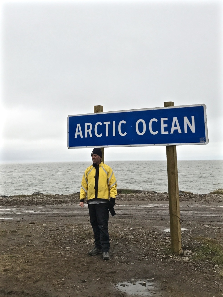 The only road in North America you can drive to the Arctic Ocean
Tuk was the goal, but getting there was the fun. It’s a tidy 3,750 kilometers from Vancouver, a journey that requires the crossing of the entire province of British Columbia (B.C.), the Yukon Territory and a large chunk of the western Arctic portion of the Northwest Territories. You start in thick Pacific Ocean air, travel through a sea of changing scenery through B.C., into the Yukon and its soaring valleys and mountain ranges, across dozens of rivers, over the Arctic Circle and eventually onto the flats of the Mackenzie River delta and over the treeless tundra of the western Canadian Arctic.
 The siren call of the Dempster Highway

Looking for wildlife along way. We saw bear, moose, caribou, fox, eagles & hawks.
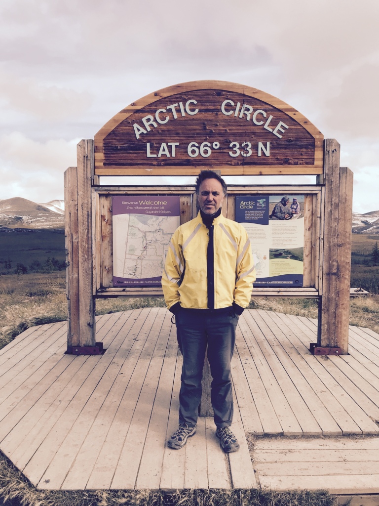 Fearless Arctic explorer crossing the Arctic Circle
 Perhaps the last tree on the tundra heading north

We kept a steady pace and slept in our tents 20 of the 22 nights. The four of us shared the driving in Greg’s Dodge truck, newly fitted with steel rims and heavy all-terrain tires. Our campsites ranged from organized provincial and territorial parks to roadside gravel pits, some rough and muddy but some magical, like the Grotto near Atlin Lake where clean spring water bubbles up from the ground and mushrooms grow in the short, wet grass.
 Mike braving the cold morning air at Tombstone Territorial Park, Yukon
 Greg looking for dinner, Derrick Lake, B.C.
 Mackenzie River ferry; one of two river crossings along the way

Greg did ALL the cooking; we ate well on pasta, curries, stir-fries, chicken with jambalaya and bannock, eggs & bacon, soups and stews. We drank wine and beer by the campfire at night and fresh coffee in the mornings. Aside from being cold and wet now and then we traveled comfortably. Against all odds Loreen seemed to enjoy being trapped in a truck for long hours with three unshaven largely unwashed middle-aged men.
 Wagon-Master and chief cook and bottle washer Greg doing his magic
 Camp chow: fried chicken, bannock, jambalaya and corn
I loved it! I love road trips and I love seeing new places, and I loved spending so much time with three people I like and admire, deep within those wild landscapes. There was essentially no friction at all, we had fun and enjoyed each other’s company. Most of all we enjoyed the scenery.
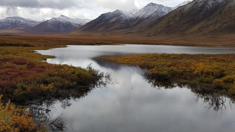
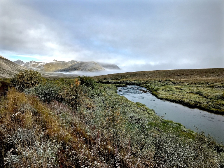
And man, oh, man is there scenery! Canada truly is one of the most spectacularly wild and beautiful places on the planet, and the variety and splendor of what we saw is impossible to put into words – hopefully some of the photos will do it even a little justice.
 (Photo by Michael Falys)


The towns were interesting too, Fort McPherson with its frontier feel and rough and tumble streets; the Mad Trapper pub in downtown Inuvik where we drank a beer and chatted with Shirley, a local Inuvialuit woman who double dog dared us to swim in the Arctic Ocean (we didn’t); the wind-chilled icy roadside gas stop of Eagle Plains where black & white photos of fur trappers and RCMP search parties hang crooked on the walls of the bar.
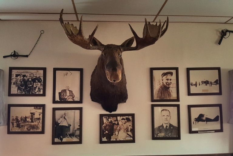 Bar at the Eagle Plains Hotel (Photo by Michael Falys)
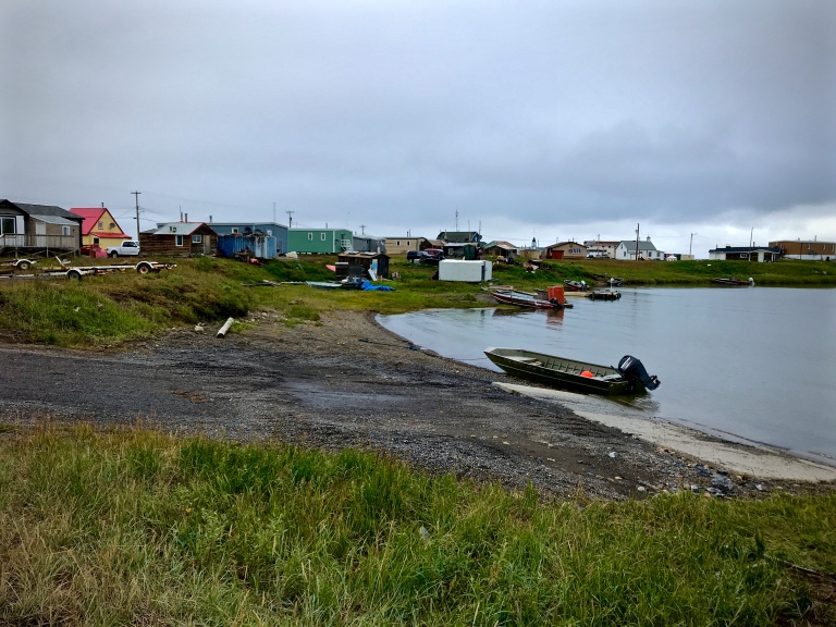
Tuk itself is unlike any place I’ve seen before. It reminds me a little of an African village, or a Newfoundland outport, or a fictitious faraway place from an Ernest Hemingway novel. It’s a winter place and a working class place, the stories of hard lives and the hard climate hanging thickly in the air.
 Tuktoyaktuk on a cold blustery afternoon
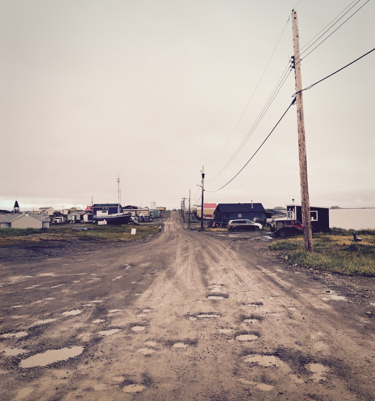 The streets of Tuk, pocked from cold summer rains

I’m embarrassed to say I still know very little about our First Nations people in Canada, although I did learn a lot about the Gwich’in and Inuvialuit peoples that make up the primary groups along our route. And thanks to Loreen’s wealth of knowledge and interest in sharing her experiences (she works for the Tzeachten First Nation) I learned a lot about issues related to governance, organization and management of Canada’s First Nations in general. Not for the first time I promised myself I’d learn more.
 Loreen enjoying a quiet evening lakeside near Inuvik
Despite everyone saying they mostly welcomed the new road, it was obvious to us that the residents of Tuk have been overwhelmed. They expected an increase in visitors certainly, but I think they underestimated the interest the new road would generate from people who found the notion of driving to the Arctic Ocean too hard to resist. We camped a night on a cold and windy gravel spit at the far north end of town along with a small handful of other hardy souls (including a couple from Switzerland enjoying a cheese fondue), but during the 24 hours we were there we saw dozens of other vehicles pull up to the spit, take a few photos in front of the newly erected Arctic Ocean sign then climb back into the warmth of their cars and trucks and return to Inuvik.
 Inuvik. Permafrost means sewer and water pipes have to sit above ground
Cold likely played a factor. Everyone we met told us how bad the summer had been, with record amounts of rain and cold. It was down to zero at night (centigrade), and we experienced snow and, well, Arctic conditions for much of the time. More than a few evenings I was happy to climb into my warm sleeping bag and hunker down for the night as the daylight slowly faded away. Despite being late into August twilight still lingered well past midnight.
 The intrepid Arctic adventurers in the midnight sun near Fort McPherson
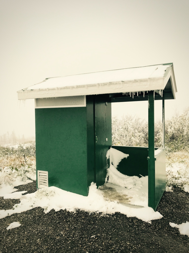 The coldest place to relieve yourself in August – Yukon rest stop outhouse
There are virtually no facilities in Tuk for tourists yet other than a small visitor information shack (manned by the capable Joel, born and raised in Tuk, now studying anthropology at Carlton University), a “Welcome to Tuktoyaktuk” sign, two portable toilets, a newly constructed picnic shelter (with no walls, mind you) and a few rusty fire pits. You can buy a Tuktoyaktuk sticker at the town hall, and the local RCMP detachment sells hats and t-shirts emblazoned with a cartoon Mountie riding a polar bear. There are two B&Bs, a small place to eat called “Grandma’s Kitchen”, and Stanton’s, a small but well stocked (with expensive stuff) supermarket.
 The Tuktoyaktuk Visitor Information Center – not quite ready for the masses
The media and government showcase the benefits of the expensive new road to the residents of Tuk: increased access to health care and government services, lower prices for groceries and commodities, better chances for social interaction with friends and family in other parts of Canada, and opportunities for investment in tourism. But a few pieces I’ve read suggest the real reason for the road: better access to the oil and gas fields in the Beaufort Sea. Money usually wins, and even if that was the main reason for the new road in the meantime we all have the chance to open the window on a little-known part of our own country and continent. And we can drive there ourselves.
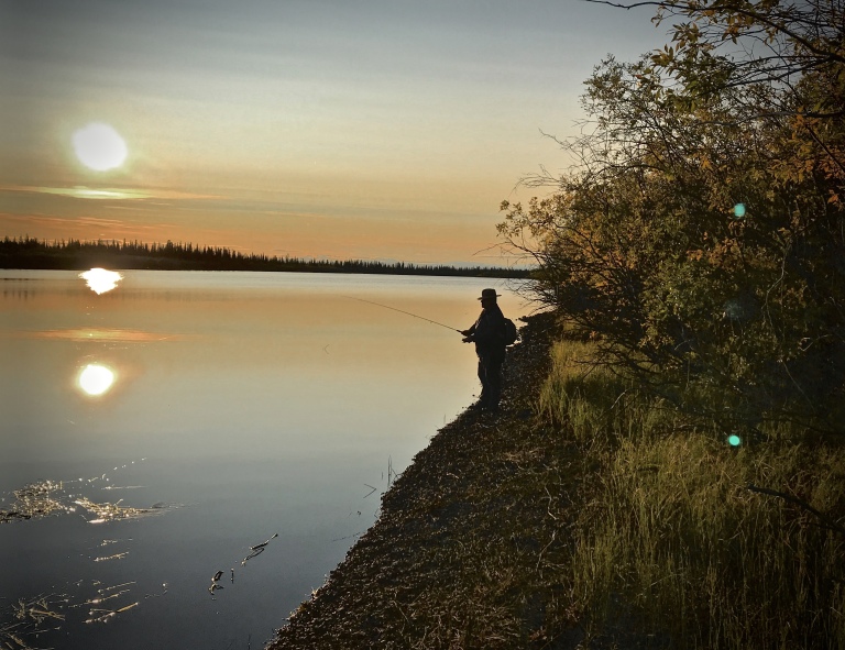 Mike casting a line near Inuvik
 Grizzly bears roam the empty plains of the Yukon (Photo by Michael Falys)
 The Liard River, northern B.C.
 One in an endless stream of soaring vistas the Canadian north has to offer
I spend a lot of time and money going to Africa, India and Turkey and Mexico when all the while there’s this huge unexplored magical place waiting for me in my own backyard.
Maybe they’ll make another road soon.
 Marshland near Liard Hotsprings
Stay Tuned!
(To see these and other shots, check out my photo sharing site on SmugMug, here).

Loved your account of your trip to “Tuk.”
LikeLike
You are my travel hero ❤
LikeLike
beautiful blog Andrew
On Sat, 15 Sep 2018 08:20 Andrew Wilson – Resting With Old Man, wrote:
> arjwilson posted: “I travel a lot, and I always find it interesting to > learn what people in other countries know and think about Canada. > Occasionally I’ll bump into someone who’s really in the know, but by and > large, when asked, the vast majority can come up with little mor” >
LikeLike
A good read. The highway should improve mine access. Ice roads are not sufficient.
LikeLike
Right. I guess there are a bunch of reason for the new road, certainly access to oil and gas is a main one, and I guess mining too. There’s very little access off the new highway, a few gravel pits and road maintenance yards, but unlike other parts of northern BC, for instance, you don’t see roads leading off into the bush to mines or much of anything else really. At the moment it’s a fairly well “sealed” road.
LikeLike
Inspiring…as always. Thanks Andrew!
LikeLike
Unbelievable adventure. I’m totally jealous!
LikeLike
You’d love it Enda! Try to get it on your list for some time in the future, it’s really Canadian!
LikeLike